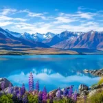
Lake Tekapo has a way of making people stop mid-sentence. You are driving along State Highway 8, the Mackenzie Basin opens up around you, and there it is, that impossible milky blue water sitting under the Southern Alps. Most visitors pull over at the lakefront, take a photo of the Church of the Good Shepherd, and move on. The ones who stay a little longer usually end up walking Mt John Summit Circuit Track, and it is, without much argument, the best short hike in the district.
I have walked this track in the middle of a stinking hot January afternoon and again on a frosty morning in winter, and both times the view from the top made the climb feel worth it. This guide covers the practical details you actually need before you go: where the track starts, how long it takes, what the two main route options look like, what the Astro Cafe is like once you get up there, and the small things that catch first-time visitors out, like the vehicle gate fee and the fact that dogs are not allowed anywhere near the summit.
Quick Facts About Mt John Summit Circuit Track
| Location | Mount John, Lake Tekapo, Mackenzie District, South Island |
| Walk start address | Tekapo Springs, 6 Lakeside Drive, Lake Tekapo 7999 |
| Summit address | Godley Peaks Road, Lake Tekapo (Mt John Observatory) |
| Full circuit distance | Approximately 8.9 km return from Tekapo Springs |
| Summit-only loop distance | Approximately 3 km if you drive to the top car park |
| Walking time | 2 to 3 hours for the full circuit, 60 to 90 minutes for the summit loop |
| Elevation gain | Roughly 300 to 370 metres |
| Difficulty | Moderate, with a steady uphill climb and a few steeper zigzags |
| Dogs | Not permitted on the track or at the summit |
| Vehicle access fee | Around $8 per car at the Godley Peaks Road gate, cash or EFTPOS |
| Facilities at the top | Astro Cafe, toilets, and the Mt John Observatory viewing area |
| Typical Google rating | Around 4.6 out of 5 from several thousand visitor reviews |
Where the Track Starts and How to Get There
The most common starting point is Tekapo Springs, a hot pools and adventure park complex a short walk from the main township at 6 Lakeside Drive, Lake Tekapo. If you park here, use the open parking on the right, since the main car park is reserved for Tekapo Springs customers. The Summit Circuit trailhead sits just to the left of the complex, marked with a Department of Conservation style sign pointing up into the larch trees.
You can also join the walk from the lakefront in the township itself, following the shoreline path past the Church of the Good Shepherd before it climbs up to meet the main track. This adds close to two extra kilometres each way but keeps you beside the water for longer, which is a nice option if you are staying in town without a car.
There is a third option that skips the walking almost entirely. Turn off State Highway 8 onto Godley Peaks Road and you can drive most of the way up Mt John itself. A gate at the base charges a small per-vehicle fee, usually around $8, payable in cash or by EFTPOS. From the summit car park, the loop track around the top takes most people 60 to 90 minutes at an easy pace, café stop included.
Two and a Half Ways to Walk Mt John
There is not just one version of this hike. Depending on your fitness, time, and whether you have a car, you can pick from three fairly different experiences. The table below breaks down how they compare.
| Route option | Distance | Time needed | Best suited to |
| Drive up, walk the summit loop | About 3 km | 60 to 90 minutes | Families, casual walkers, photographers short on time |
| Full circuit from Tekapo Springs | About 8.9 km | 2 to 3 hours | Fit walkers wanting the complete forest-to-summit experience |
| Extended loop via the lakeshore | About 11 km | 3 hours or more | Experienced walkers wanting extra lakeside scenery |
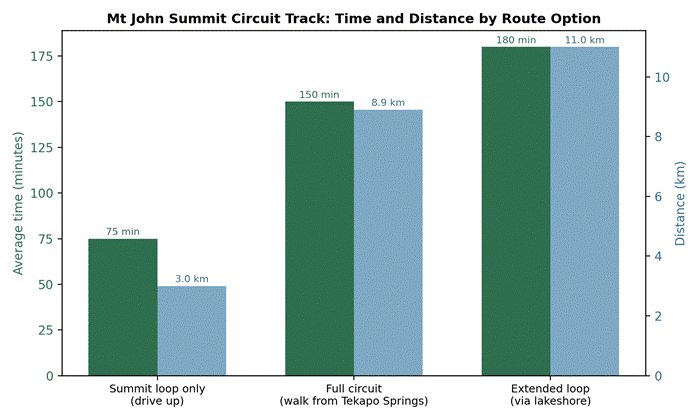
Time and distance compared across the three ways to walk Mt John Summit Circuit Track
Walking the Full Circuit, Step by Step
The forest climb
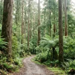
From Tekapo Springs, the track heads straight uphill through a plantation of larch and pine. This first section takes around 30 minutes and is the steepest, most sustained climbing of the whole walk. It zigzags up the southern face of the mountain, which keeps you shaded from the sun for most of the morning, though it also means the path can turn slick and muddy after rain, so proper shoes matter here more than anywhere else on the route.
Breaking into open tussock
Once you clear the tree line, the track opens onto golden tussock grassland and a broad ridge. This is where the walk starts paying off. Lake Tekapo appears below in full, along with glimpses of the Two Thumb Range across the water. The gradient eases considerably through here, and it is a good spot to slow down and actually look around rather than just put your head down and climb.
The summit and observatory
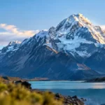
The final approach brings you up onto Mt John itself, home to the University of Canterbury’s Mt John Observatory and a cluster of white telescope domes. This is one of the reasons the Mackenzie Basin carries such a strong reputation for stargazing, sitting inside the Aoraki Mackenzie International Dark Sky Reserve, one of the largest dark sky reserves anywhere in the world. From the summit platform, on a clear day you can pick out Aoraki Mount Cook to the northwest, the full length of Lake Tekapo below, and the patchwork farmland of the Mackenzie Basin stretching out in every direction.
The loop and the way down
The Summit Circuit itself loops around the top of the mountain, and you can walk it clockwise or anticlockwise depending on which way the wind is blowing, which up here can matter more than you would think. Once you are done at the top, most walkers retrace their steps back down through the forest, though the extended lakeshore option lets you descend a different way along the water’s edge if you have the time and energy left.
Astro Cafe and the Mt John Observatory
Sitting right at the summit, the Astro Cafe has floor-to-ceiling windows looking straight down over Lake Tekapo, which is a serious reward after an uphill walk. It generally opens around 9am and runs through to late afternoon, though hours shift with the seasons and it can close early in strong wind or heavy rain, since the whole access road depends on weather conditions.
Coffee here is popular enough that each cup comes with a little dusting of a planet pattern on the foam, and the cabinet food covers the usual mix of muffins, slices and savoury pies. It gets busy around lunchtime, so if you want a table with the view and not just a takeaway cup, aim for a mid-morning or a late afternoon visit.
The observatory itself is a working research facility, not a museum, so daytime visits are mostly about the building and the setting rather than a tour. If you want the astronomy side of things properly, that is usually done through an evening stargazing tour rather than as part of the daytime walk.
Best Time of Day and Season to Hike Mt John
Early morning is my pick for this walk, particularly in the warmer months when the Mackenzie Basin heat builds up fast by midday and the summit has almost no shade. Starting an hour or two after sunrise gets you up top before the crowds arrive by car, and the light across the lake tends to be softer and more photogenic than the flat glare of midday.
If you want to plan your start time around actual daylight hours rather than guesswork, it is worth checking sunrise and sunset times across New Zealand before you head out, since Tekapo sits well inland and daylight can shift noticeably between seasons.
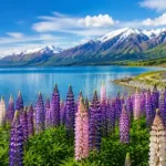
Seasonally, the walk is possible year-round, but each season shows a different side of the Mackenzie. Summer brings long daylight hours and dry trails. Autumn turns the larch forest a rich gold. Late spring through early summer is when the region’s famous lupins are at their peak along the lakeshore roads nearby, and if that timing lines up with your trip it is worth reading about where and when to see lupins in New Zealand so you do not miss the bloom.
Winter is quieter and often stunning, with snow dusting the tussock, though the track can turn icy in shaded sections and the drive up Godley Peaks Road occasionally closes after heavy snowfall. Check current conditions before setting out if you are visiting between June and August.
How Hard Is the Mt John Summit Circuit Track?
This sits comfortably in the moderate category. It is not a technical hike, there is no scrambling or exposure to worry about, and the path is well formed the entire way. What makes it feel harder than the distance suggests is the steady, mostly uninterrupted climb through the forest section, plus the wind exposure once you clear the tree line. Reasonably fit walkers with no hiking background manage the full circuit without much trouble. Families with younger children, or anyone wanting the view without the workout, are usually better off with the drive-up option and the shorter summit loop.
What to Pack and Safety Tips
A few sensible precautions make a real difference on this walk, mostly because the weather at the summit can be a different world to what you left down at lake level.
- Wear proper walking shoes or boots, since the forest section gets muddy and the descent can be slippery on wet roots and rock
- Bring a warm layer even in summer, because the exposed ridge and summit catch a cold wind regardless of the season
- Carry water and a snack, particularly if you are doing the full circuit rather than the short summit loop
- Take sun protection seriously, since the Mackenzie Basin has very little cloud cover on clear days and UV levels run high
- Leave dogs at your accommodation, as they are not permitted on the track or around the observatory
- Watch your footing on icy or wet rock slabs after rain or snowfall, especially near the summit lookout points
- Keep an eye on children around the rocky outcrops at the top, and stick to the formed trail rather than cutting across tussock
- Carry a small first aid kit and let someone know your rough plan if you are walking solo
Nearby Things to Do Around Lake Tekapo
Once you are back down, Tekapo Springs is right there if your legs are asking for a soak in the hot pools. The Church of the Good Shepherd on the lakefront is a five minute stroll from the township and worth the short detour for photos alone. If you are building out a longer South Island itinerary around this hike, it is also worth thinking about timing your visit around school terms, since accommodation in the Mackenzie region tightens up considerably during peak periods, and a quick check of
when New Zealand school holidays fall can save you from booking into the busiest weeks without realising it.
For those continuing further south afterwards, Queenstown is a popular next stop, and if coffee matters to you as much as the scenery, our roundup of the best cafes in Queenstown is worth a look before you arrive.
For wider background on the town itself, Lake Tekapo on Wikipedia covers its history and setting within the Mackenzie Basin, and the Aoraki Mackenzie International Dark Sky Reserve entry explains why this particular patch of New Zealand is so protective of its night skies.
Frequently Asked Questions | Mt John Summit Circuit Track
How long does it take to hike Mt John Summit Circuit Track?
The full circuit from Tekapo Springs takes most people 2 to 3 hours return, including time at the top. If you drive up to the summit car park instead, the loop track alone takes 60 to 90 minutes at a relaxed pace.
Where does the Mt John walk start?
Most walkers start at Tekapo Springs, 6 Lakeside Drive, Lake Tekapo, with parking available in the open spaces beside the complex. You can also join the track from the lakefront in the township, which adds roughly two kilometres each way.
Can you drive to the top of Mt John?
Yes. A sealed private road off Godley Peaks Road leads to the summit car park, with a gate fee of around $8 per vehicle. From there, the summit loop is about 3 kilometres and takes 60 to 90 minutes.
Is Mt John Summit Circuit Track dog friendly?
No. Dogs are not permitted on the track or around the summit and observatory area, largely to protect local wildlife and the working observatory environment.
How difficult is the hike?
It is rated moderate. The forest section involves a steady, at times steep, uphill climb, but the path is well formed throughout with no scrambling or exposed sections. Reasonably fit walkers manage it without specialist gear.
Is there a cafe at the summit?
Yes, the Astro Cafe sits right at the top with floor-to-ceiling windows over Lake Tekapo. It typically opens from around 9am into the late afternoon, though hours and opening can vary with the weather.
What is the best time of year to walk Mt John?
The track is walkable year-round. Summer and early autumn offer the longest daylight and driest trail conditions, while winter brings snow and occasional icy sections, so check conditions before heading out between June and August.
Is the Mt John walk suitable for children?
Younger children can usually manage the shorter summit loop if you drive up, though the full circuit’s steady forest climb can be tiring for very young walkers. Supervise kids closely around the rocky lookout points at the summit.
Related Reads
- Where and When to See Lupins in New Zealand
- The Best Cafes in Queenstown, New Zealand
- When Are New Zealand School Holidays? The Complete Term Dates Guide